UN Environment Programme Mangrove Mapping
Developing digital tools for mapping ecosystem value, protection gaps, and coastal resilience.
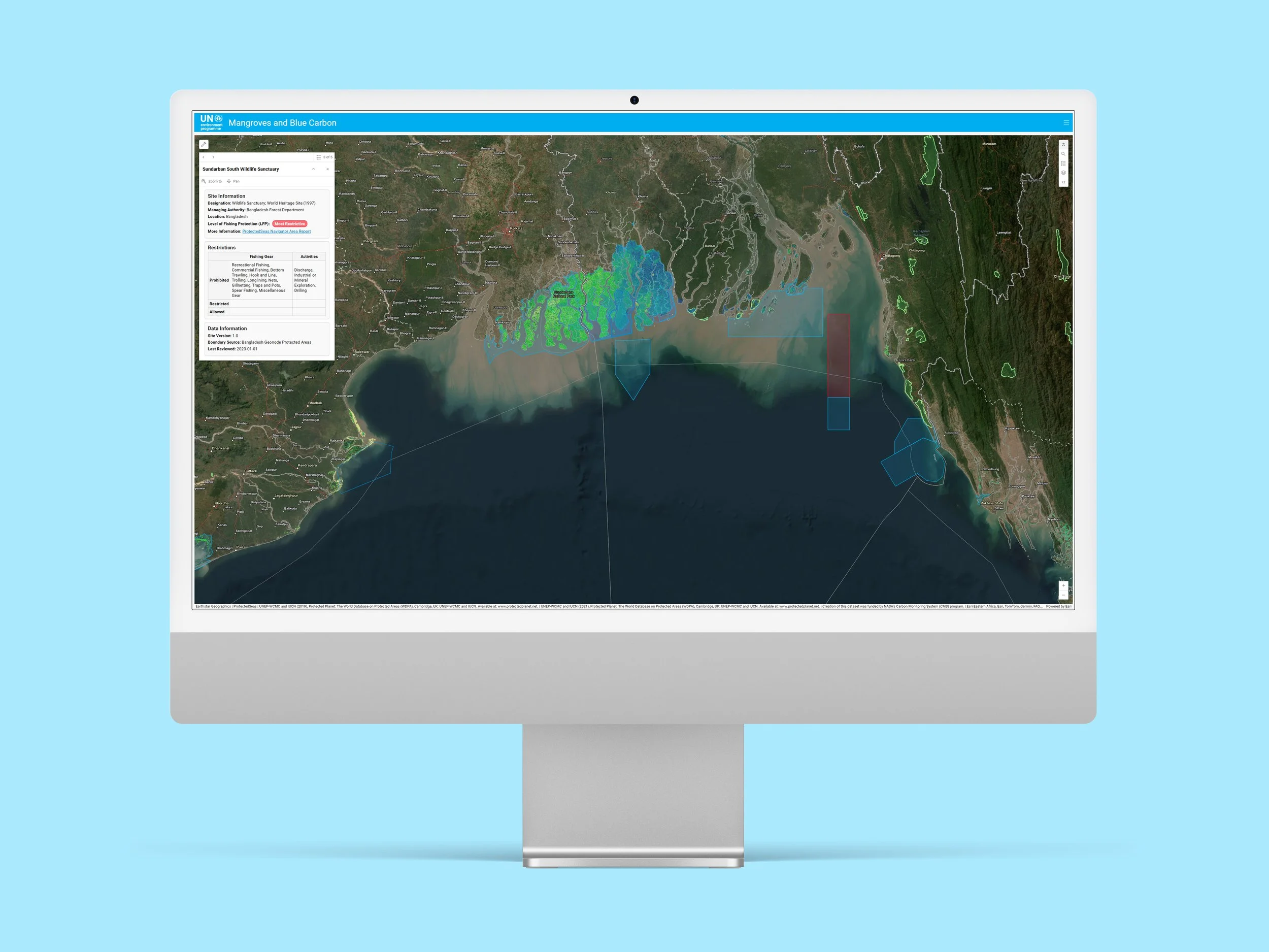
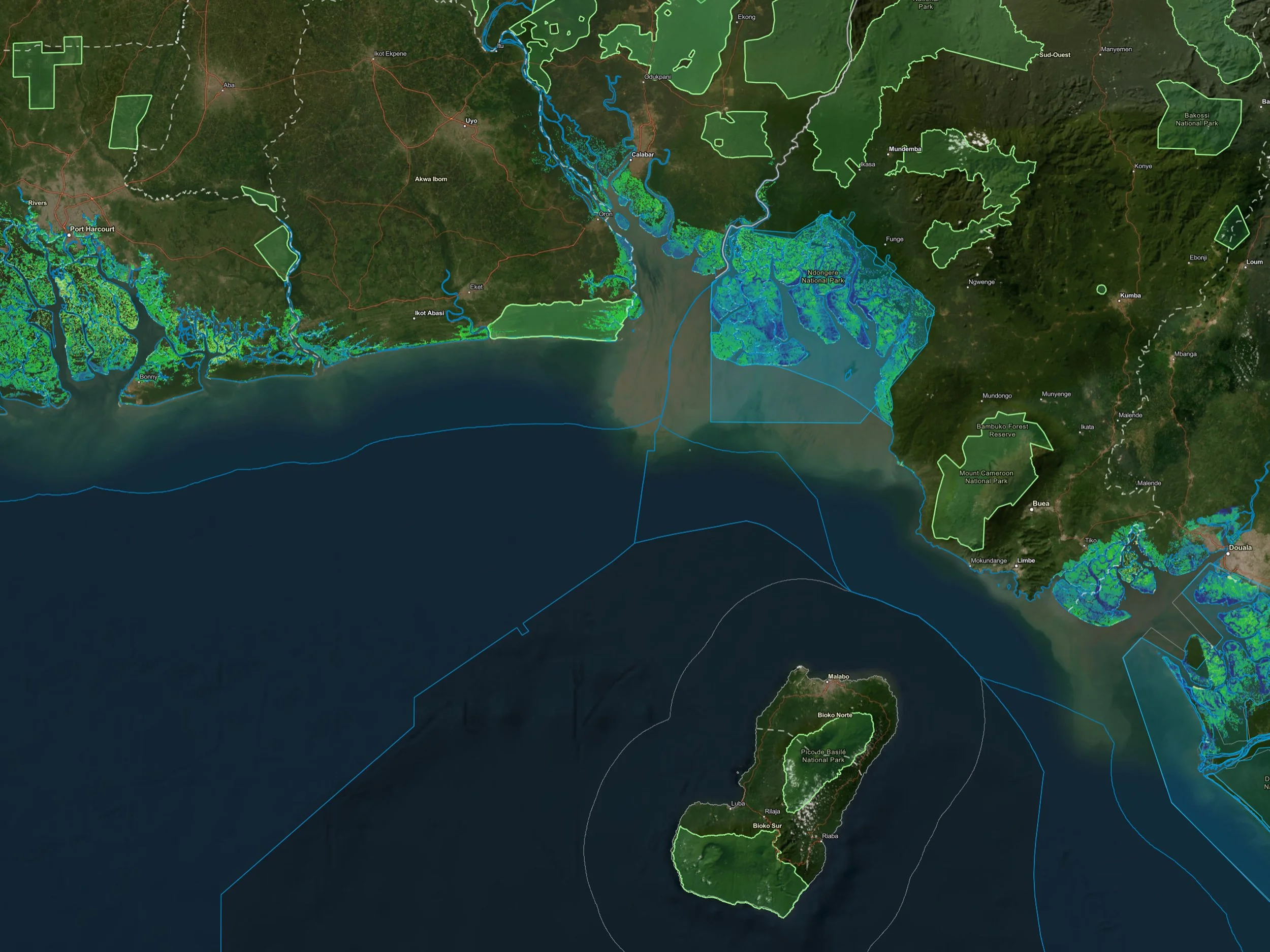
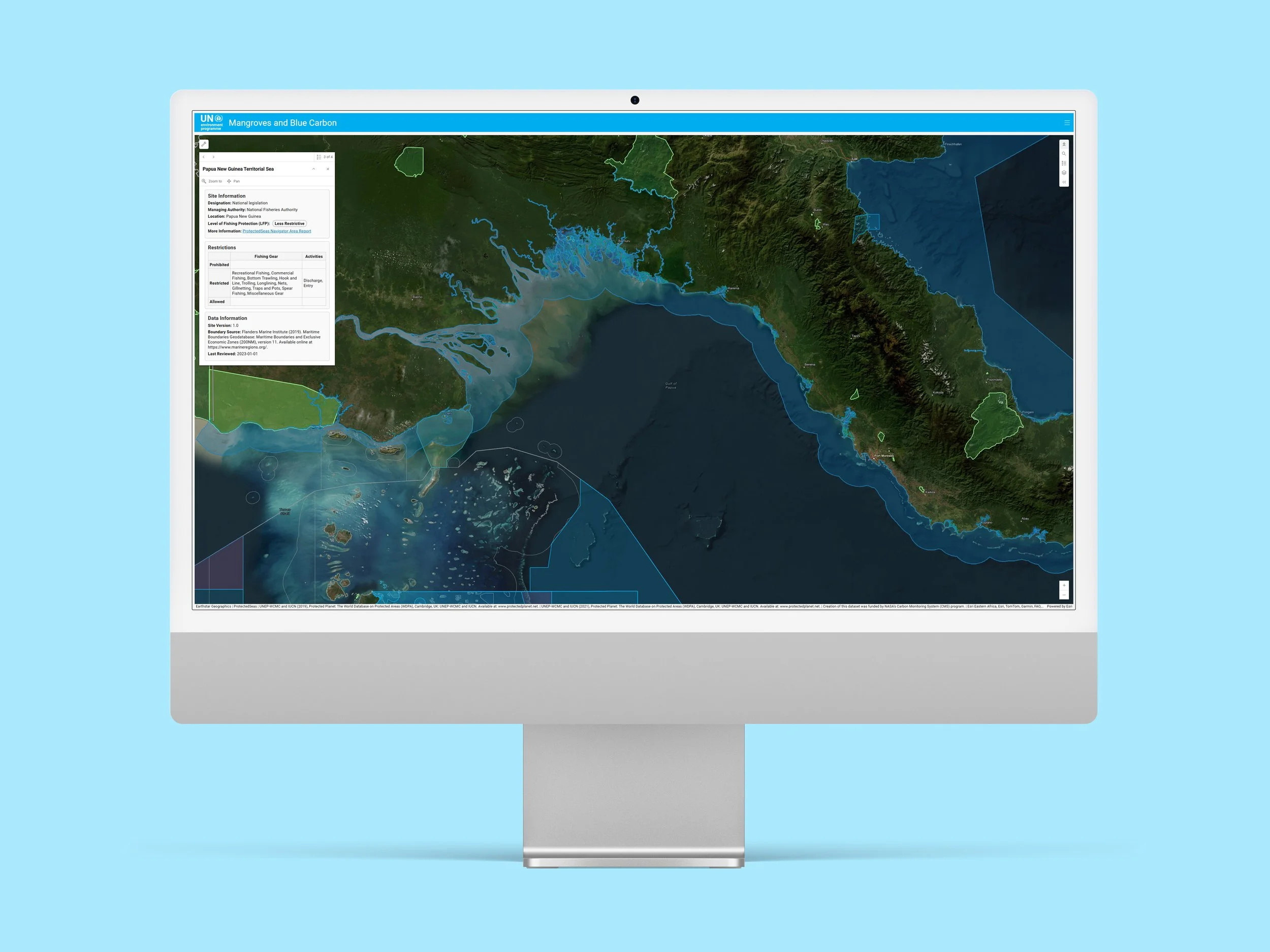
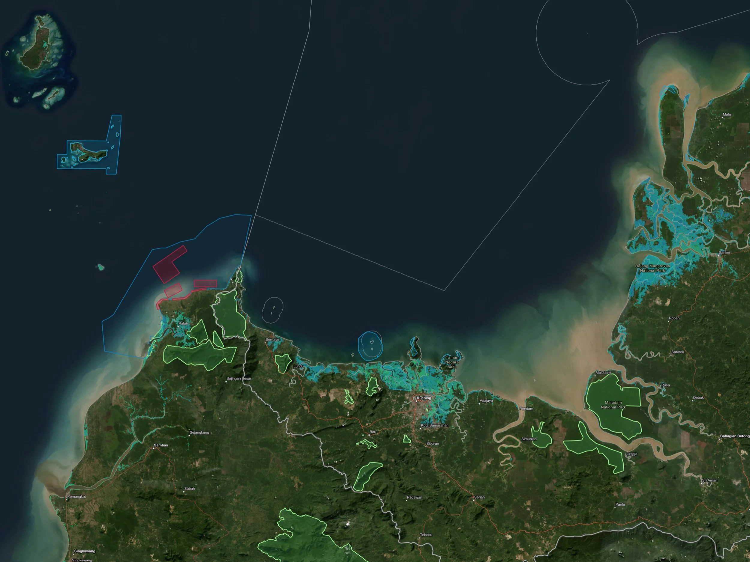
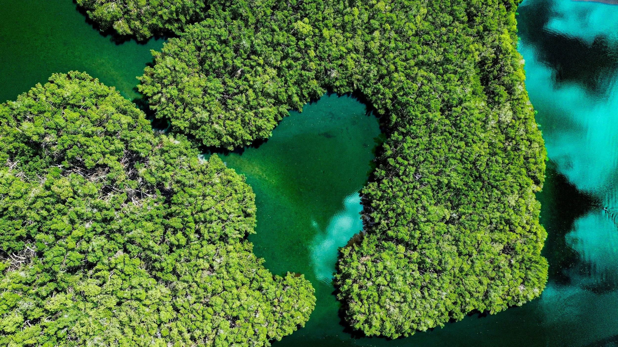
Mangroves have emerged as one of the world’s most valuable natural climate-solutions, storing vast amounts of carbon, protecting vulnerable coasts, and supporting essential ecosystem services. Recent analyses estimate mangroves to be worth at least US $1.6 billion per year in ecosystem services, with an annual value of USD $33,000 – $57,000 per hectare, and underscoring how critical they are to both climate resilience and coastal economies. As global interest in carbon markets, nature-based solutions, and blue-carbon finance accelerates, there is a growing need for transparent, spatially explicit data to guide investment, conservation, and restoration decisions.
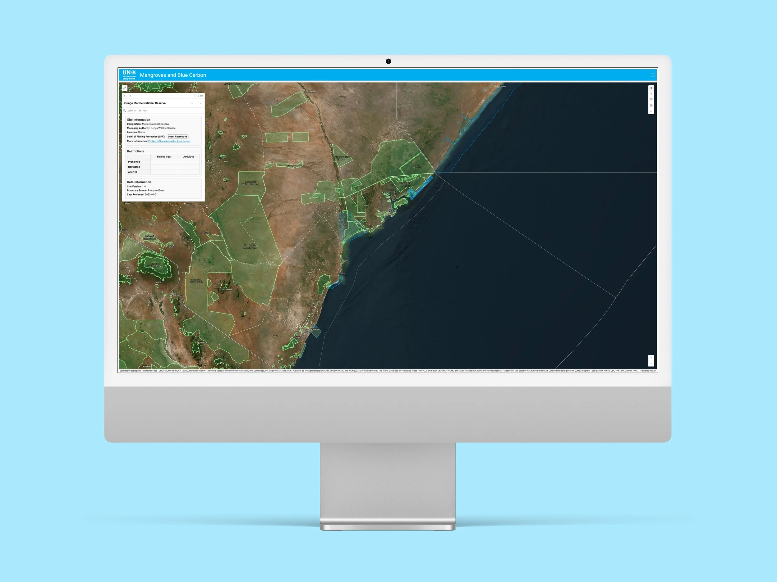
In support of UNEP’s work protecting and restoring blue-carbon ecosystems, we developed an ArcGIS Online web-based platform that maps global mangrove extent alongside protection status, coastal population and infrastructure exposure, and potential blue-carbon project zones. The platform enables users to rapidly identify protection gaps, prioritise regions where mangrove loss could endanger communities and assets, and highlight high-potential sites for conservation or restoration finance.
By blending spatial analytics with user-friendly, finance-relevant indicators, the platform supports teams working on blue-carbon pipelines, national climate commitments (NDCs), and sustainable blue-finance mechanisms - helping bridge the gap between ecological science, policy, and real-world investment.
2023 - 2025