Oxford Properties
Geospatial and demographic analysis, mapping, and cartographic design to support large-scale retail leasing and development.
Oxford Properties is a global real estate investor, developer, and manager with a diverse portfolio valued at roughly $80 billion across four continents. Established in 1960, it serves as the real estate arm of OMERS, one of Canada’s largest pension funds. Its retail centres function as major urban anchors, shaping transit patterns, influencing growth, and serving as key destinations within broader planning frameworks.
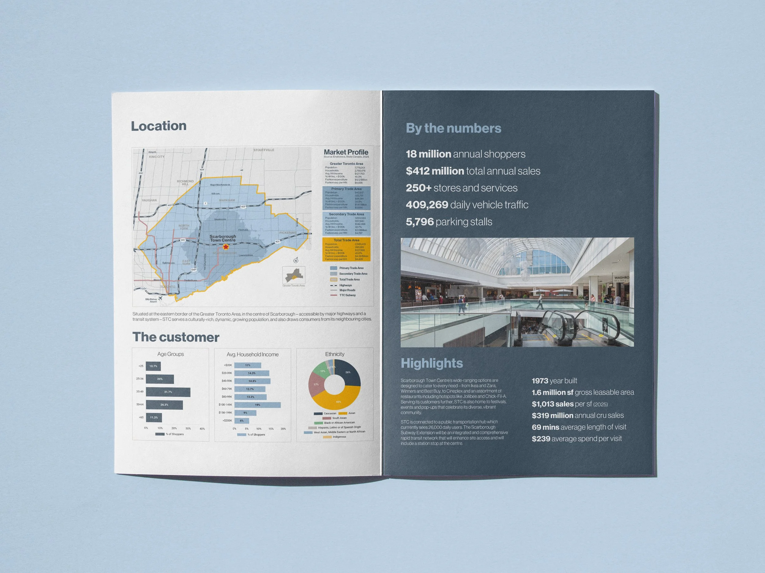
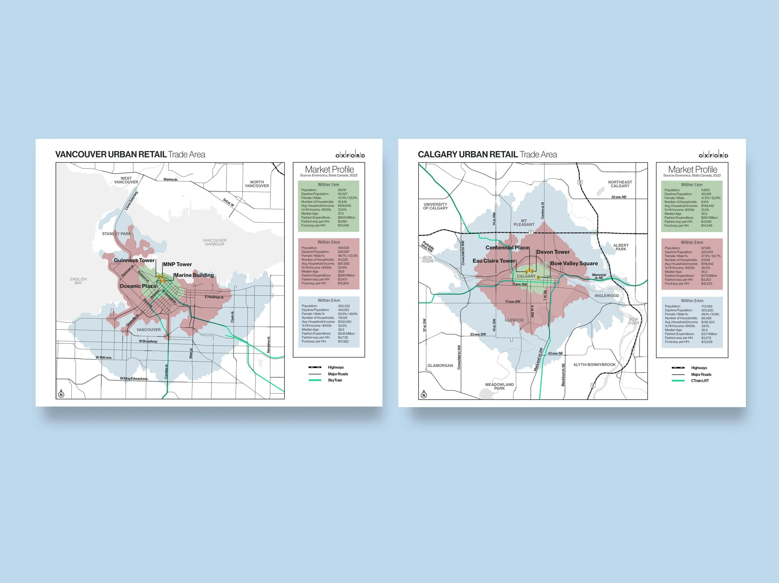
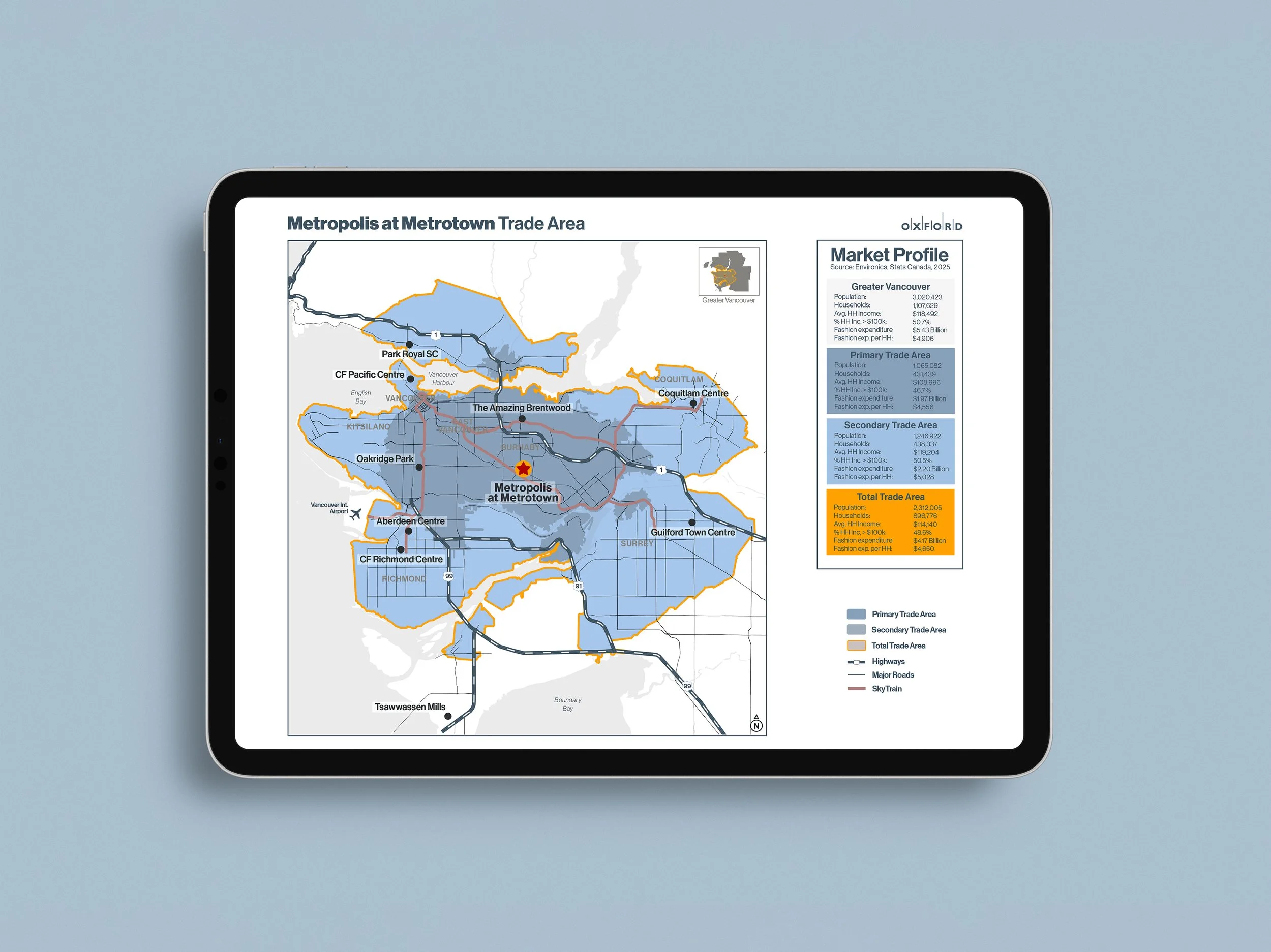
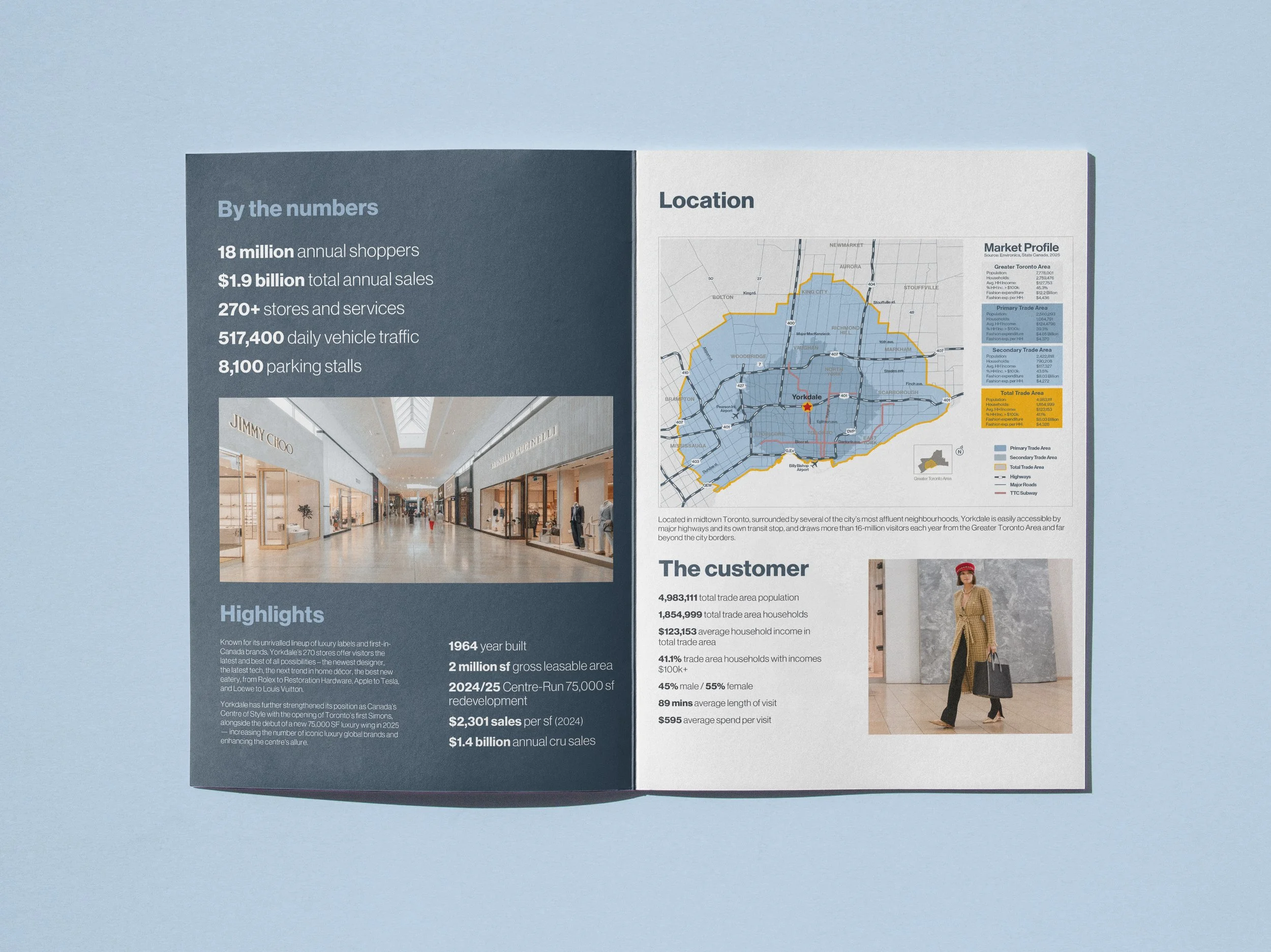
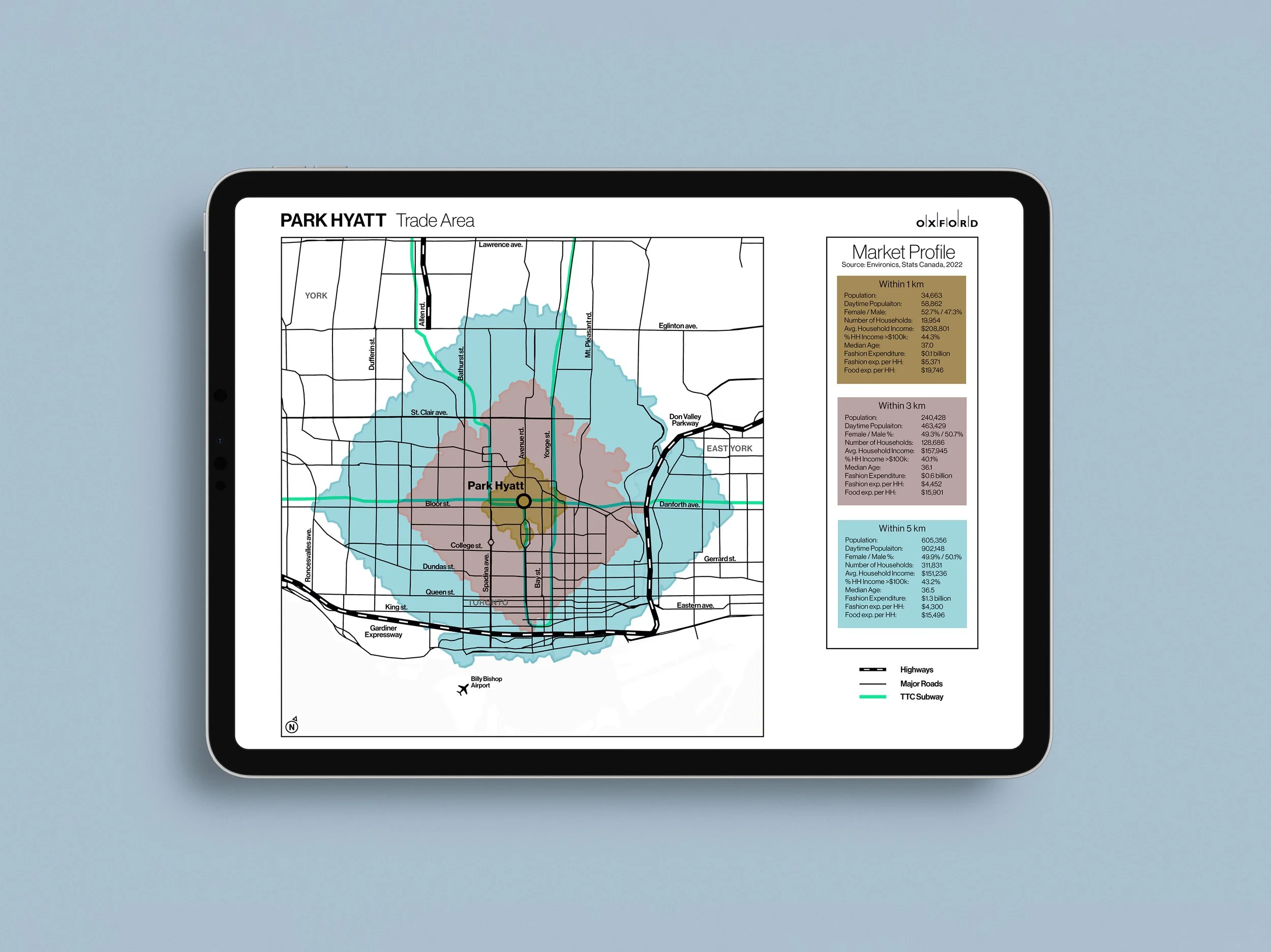
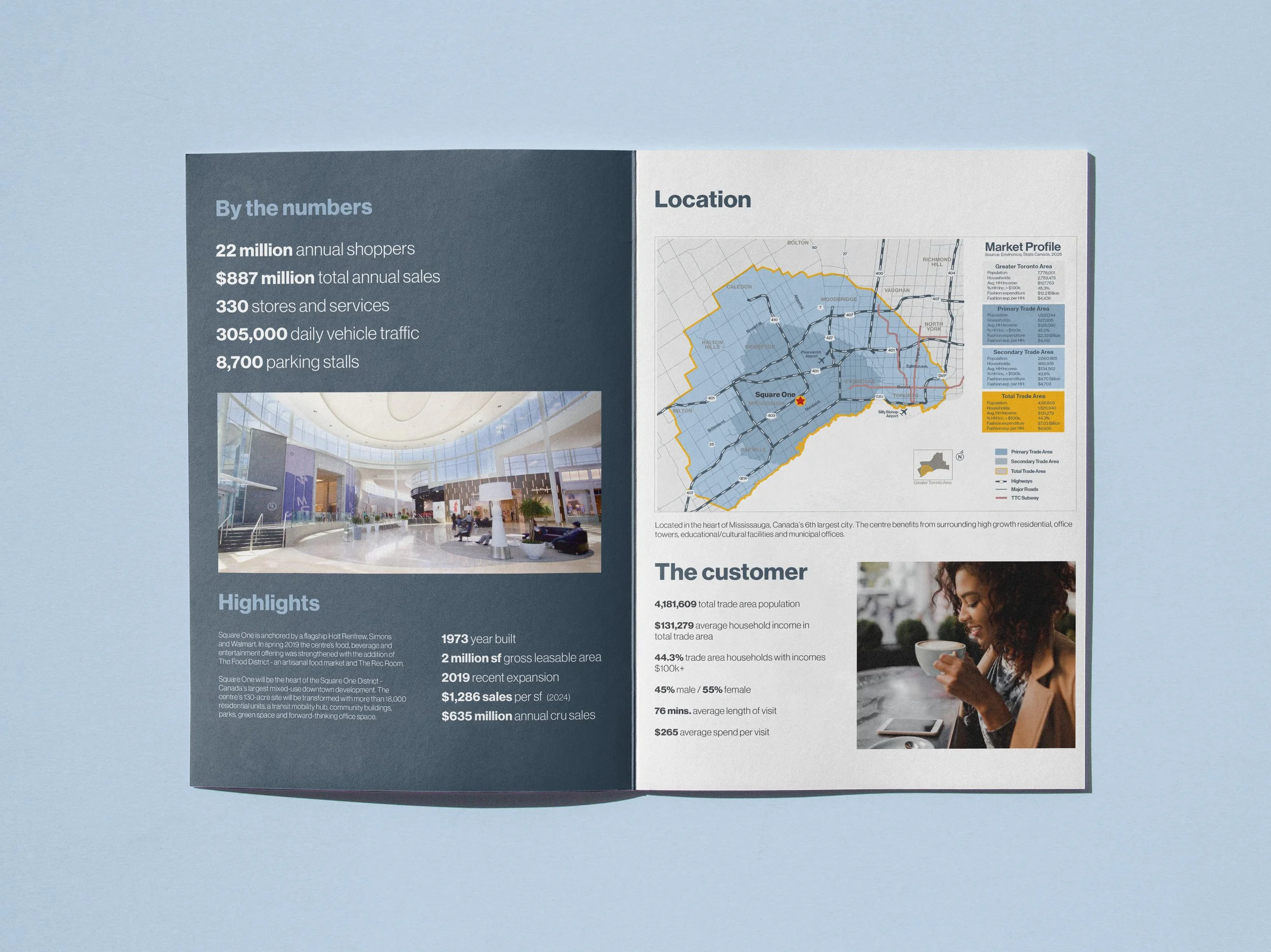
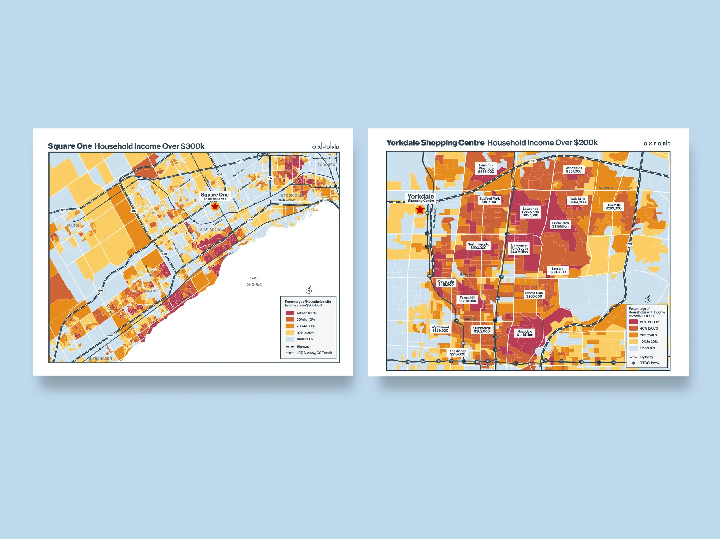
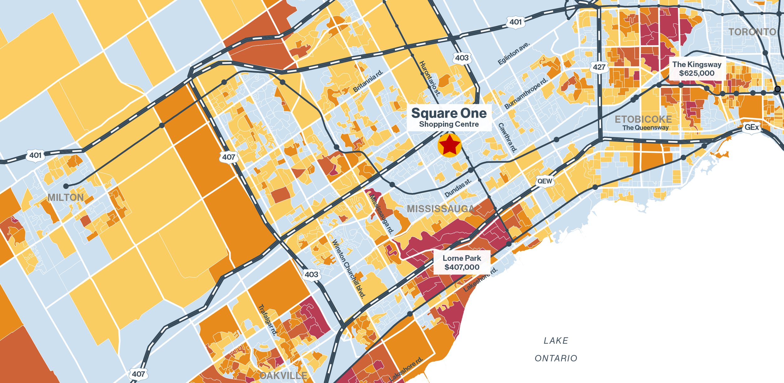
Our work with Oxford focuses on supporting large-scale retail planning through clear, data-driven spatial analysis. This has included trade-area demographic studies, residential density analysis, and broader urban retail mapping across key Canadian assets such as Yorkdale and Square One Shopping Centres. We produce a wide range of outputs, from static maps and graphics used in leasing material to internal ArcGIS Online tools for demographic and trade-area analysis, leveraging data from Environics, Stats Canada and other sources to help inform long-term planning and decision-making.
2020 - Ongoing